Home > Tech Support
> Aerospace
Aerospace
At our research facility, we specialize in developing hardware and software systems for a navigation and meteorological observations.
This includes stationary, mobile, and airborne devices, allowing us to provide comprehensive solutions for a variety of applications.
Whether you need advanced navigation systems for vehicles or aircraft, or state-of-the-art weather observation tools for research or commercial purposes, our team of experts has the skills and experience necessary to deliver cutting-edge solutions that meet your unique needs.
Trust us to be your partner in developing the next generation of technology for navigation and meteorological observations. Contact us today to learn more about our capabilities and how we can help you achieve your goals.
Most of our aerospace research projects involve long-term logging with networked sensor arrays, big data analysis, and occasional incident investigations. It is thus related to our Forensics Division.
Aviation Weather
For a select group of clients we monitor weather at specific locations around the globe and store it in logs for later analysis. The combination of ACARS, ADS-B, METAR and TAF systems give very detailed reports in a compact text format. This can then be analysed with data mining tools.
FOSS Satellites
Free and open source hardware and software satellites make space research affordable.
They are small and relatively inexpensive to deploy.
Rockets are designed to carry a specific payload.
If the main payload is lighter than that, the spare capacity is topped up with small loads.
ACARS Aircraft Communications Addressing and Reporting System
ACARS is a digital datalink system for transmission of short messages between aircraft and ground stations via airband radio or satellite. The protocol was designed by ARINC and deployed in 1978, using the Telex format.
The ACARS term refers to the complete air and ground system, consisting of equipment on board, equipment on the ground, and a service provider. On-board ACARS equipment consists of end systems with a router, which routes messages through the air-ground subnetwork.
Weather Data
Of particular interest to us are the weather reports which complement our own weather logs.
In 2002, ACARS was added to the NOAA Observing System Architecture.
Commercial aircraft can act as providers for weather data,
sending meteorological observations like wind and temperature over the ACARS network.
ADS-B Automatic Dependent Surveillance Broadcast
ADS-B is a technology in which aircrafts determine their position via satellite navigation and periodically broadcast it in the form of very short messages (squitters), enabling them to be tracked.
The information can be received by air traffic control ground stations as a replacement for secondary surveillance radar, as no interrogation signal is needed from the ground. It can also be received by other aircraft to provide situational awareness and allow self-separation.
ADS–B is "automatic" in that it requires no pilot or external input. It is "dependent" in that it depends on data from the aircraft's navigation system. ADS-B equipped aircraft emit their exact position, speed and heading. Those that don't provide positions can be tracked via multilateration (MLAT) when the signal is received by three or more receivers.
Enhanced Surveillance (EHS) includes more details about the aircraft status, navigation intent, and weather at altitude.
A large community of keen enthusiasts and government agencies operate receivers that track ADS-B equipped aircraft flying around the globe. They share this data with websites that collate and publish it on maps. We operate a number of receiving stations, both stationary and mobile.
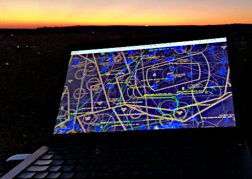
ADS-B / Mode-S Mobile Air Traffic Radar
SDR Software Defined Radio
Radio components such as modulators, demodulators and tuners were traditionally implemented in analogue hardware components. The advent of modern computing and analogue to digital converters allows most of these components to be implemented in software instead. Hence, the term software defined radio. This enables easy signal processing on low cost wide band scanner radios.
The SDR can be used as a real time air radar. ADS-B broadcasts at a frequency of 1090 MHz. The SDR can be used to listen to these ADS-B signals, which can then be used to create your very own aircraft radar system.
However, note that for safety reasons the SDR should not be used for ADS-B navigation in a real aircraft, as it may not be precise or stable enough.
Aviation Weather
We monitor weather around the globe and store it in databases for later analysis. METAR and TAF systems give very detailed reports in a compact text format.
METAR
METAR is a format for reporting weather information, predominantly used by pilots as a pre-flight weather briefing, and by meteorologists who use aggregated METAR information to assist in weather forecasting.
Raw METAR is the most common format in the world for the transmission of observational weather data. It is highly standardized through the International Civil Aviation Organization (ICAO), which allows it to be understood throughout most of the world.
A typical METAR contains data for the temperature, dew point, wind direction and speed, precipitation, cloud cover and heights, visibility, and barometric pressure. It may also contain information on precipitation amounts, lightning, and other information that would be of interest to pilots or meteorologists such as a pilot report or PIREP, colour states and runway visual range (RVR).
Our weather logs from several years are used for statistical analysis of weather trends around airports.
This is supplemented with weather data from ACARS and ADS-B systems.